Two local students receive Conexus Youth Leadership Awards
July 21, 2025, 10:24 am
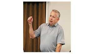
Ryan Kiedrowski, Local Journalism Initiative Reporter

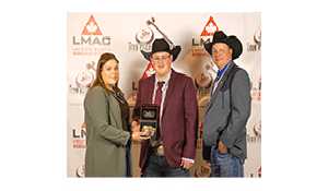
This years Youth Leadership Awards from Conexus Credit Union were announced recently with two locals named as recipients. Rocanvilles Jeffrey Hutchinson and Whitewoods Hunter Beutler are among the eight 2025 high school graduates to receive a $5,000 scholarship from a pool of 84 candidates.
We were just really encouraged with the level of engagement, that people see this as a good bursary and really helpful for them in their pursuit of education, said Celina Philpot, CEO of Conexus Credit Union. When we get the number of applicants that we do, we know this program makes a difference. We are really encouraged by the number of applicants that put their names forward.
Joining Huchinson and Beutler in this years lucky eight are Kalianna Goforth from QuAppelle; Haley Ott from Regina; Coral Frenette from Prince Albert; Freddie Comfort from White City; Jaycee Adams from Moose Jaw; and Esther Akinjobi from Prince Albert.
As the awards name suggests, successful applicants have demonstrated their leadership abilities at the local level.
Any kind of special contributions, be it through coaching or leadership or community involvement, Philpot explained, adding it also encompasses how the individual plans to maintain that leadership spirit in the future. What they want to pursue, looking for the leaders of tomorrow and how they exercise leadership within the context of their world today. That is really what were looking for.
Some of the notes on how Hutchinson demonstrated leadership to the Conexus selection committee included his volunteer work to DJ the SRC Halloween dance, leading the arts programs at school, and initiative in academics and extra-curricular activities.
For Beutler, it was her hours spent coaching youth, helping to build their confidence on and off the field. She also works at a local daycare, and is often part of school and community events. Skate nights, fundraisers and initiatives that support families and youth are where shes commonly found.
All the applicants were fantastic, and its hard to pick amongst a group of young people so committed to adding value to their communities and showing up as young leaders, Philpot said. Theyre all very good in their own right. A good problem to have, but also a difficult challenge in picking only eight.
Open to all Conexus Credit Union members, the Youth Leadership Awards are meant to give students an initial boost as they enter the post-secondary education world.
We have reviewed it and increased the amount since Ive started here, Philpot said. University tuition is expensive, so we wanted to be able to support as many as we could, but also have a meaningful contribution. At least taking care of that first tuition with some books and take a little bit of that pressure off, because most of these programs are two years, if not five.
We understand how challenging it is and the commitment that these young people have to make to their studies, Philpot continued. Its an investment in themselves, and we want to demonstrate that we want to invest in you, too. Youre the future.
Conexus Credit Union has been offering the Young Leadership Award since 2018.
Hutchinson heading to U of S
Upon learning that he received the scholarship, Hutchinson admits that hes still in a bit of shock.
Its really gratifying, being selected, Hutchinson said. Especially in their email, they told me that I was selected out of 84 applicants, so its super rewarding in that regard, too. I feel like I havent really processed it yet! It will be so helpful in the fact that it eases the financial burden of heading off to university, he said. Life hits you when you get to universityit gets expensive, and the more scholarships, the better.
This is one of seven scholarships Hutchinson will be receiving as he makes his way to Saskatoon and university life.
Im headed to Edwards School of Business in Saskatoon at the U of S, taking my four-year undergrad there, he said. Id like to get into law school after, thats kind of what Im gunning for right now. Who knows, that idea might change down the road, but the University of Saskatchewan, they also have a really awesome combined program where you can get your undergrad and law done in six years instead of seven, so it shaves off a year and so you can get both your degrees in a year less.
Hutchinson also noted in his experience, applying for scholarships can be a team effort.
A lot of these scholarships ask for letters of support, so I get to reach out to leaders that Ive worked with in the community and even within my school community, he explained. It takes a team to get to scholarships, I couldnt have done it alone. This Conexus one, even my high school math teacher, Mrs. Spurr, she helped me with it.
Recounting the moment he learned he had secured one of the eight Youth Leadership Awards, Hutchinson said Mrs. Spurr gave him a high five after he showed her the email.
It was just really rewarding for her as well, seeing a follow through, Hutchinson said of Mrs. Spurr, whom he described as very personable and supportive of her students. Some teachers might write these letters of reference and help students out, but they dont get to maybe see the outcome. But she was super awesome. She was really thrilled and really happy for me as well to receive it, and that kind of support, it means the world.
As for his advice to high school students interested in applying for scholarships, Hutchinson explained how organization and determination certainly pay off.
Have a to-do list thats my best friend, he said, expanding how he also categorizes lists specific to homework, scholarships, and personal life. Its mostly like the homework and scholarships ones during the school year.
Between school, applying for scholarships, and working part time at the Red Barn, Hutchinson says, its definitely a lot to juggle, especially in your Grade 12 year, but its doable.
I still found ways to have freedom, hang out with my friends and go to Tims, he said.
Effective email communication, utilizing the advice of career counsellors, and diligently searching through the multitude of scholarships available are key areas.
With scholarships, there are a plethora out there, Hutchinson said. The school division webpage, if you go under the Student tab and under Scholarships, they have an awesome breakdown of all the scholarships that are offered locally.
All his dogged persistence has come to fruition as Hutchinson has secured $57,000 in total scholarships, including local awards like the Deep Roots Foundation from the Hebert Group worth $2,000 and the $1,000 RM of Moosomin award. At one point, Hutchinson found himself with the difficult decision of choosing between the University of Albertawhich was his initial choiceand the U of S, both schools featuring excellent monetary incentives to join.
I did weigh my options, and it just made more sense for me to go for Saskatoon and go and take on the big scholarships, he said, pointing to the $30,000 Entrance Scholarship the U of S offered, plus the $24,000 Edwards Best and Brightest Undergraduate Scholarship.
Luckily, with my scholarships, its kind of a full ride for me, Hutchinson said. I have some pretty big scholarships through the university that Ive been really fortunate to have received.
Beutler going to U of R
Being named as one of this years recipients of the $5,000 Youth Leadership Award is an honour Beutler is grateful for.
I was pretty honoured to be one of the recipients of it, she said. It was pretty meaningful, the recognition Ive gotten from doing all that work in my community and knowing others see that potential in me as a leader; it was pretty motivational.
After graduating from Whitewood High School, Beutler will be heading to the University of Regina to pursue a degree in Education.
My goal is to inspire and support young learners by creating a classroom where every child feels seen and encouraged, she noted.
Beutler is particularly interested in Elementary Education, noting Ive always loved working with kids, so I knew that was what I wanted to do. Her experience at the local daycare cemented the idea of what her education and career path will look likeit had to include kids.
This past year I got a job at the daycare in my town, and that was kind of when I realized I want to work with kids, Beutler said. I just love going in and all the kids being like, oh my gosh, Hunter, I cant believe youre here! and so happy to see me. It makes my day, every day!
In addition to the Conexus Youth Leadership Award, Beutler was also one of two recipients of the $1,000 Saskatchewan Snowmobile Association Scholarship. She also applied for a scholarship sponsored by Nutrien, and is awaiting their announcement.
The best way I found applying for them was asking your friends and going online, said Beutler of her scholarship application advice. I had a friend that was going to school in university this year, and I asked her about all the ones she applied for last year, and she helped me out with those and told me some good ones.
While Beutler is just beginning her four-year program at the U of R, she fully intends to come home to Whitewood upon completion.
I definitely do, she said without hesitation when asked about returning home after school. I love my hometown, and I love all the kids in it. I know them all from the daycare. Our school is Kindergarten to Grade 12, so Ive grown up with all the kids in there and all the parents.
Another bonus with Beutlers decision to attend the U of R is the close enough, but far enough away distance from home.
I have a few friends going there, so that would give me a place to live with the people I know to go to school there, and its fairly close to home, she said. But its still a little bit away, so it gets me away, but I can always come home when I need.


-SM.jpg)